MMBW plans
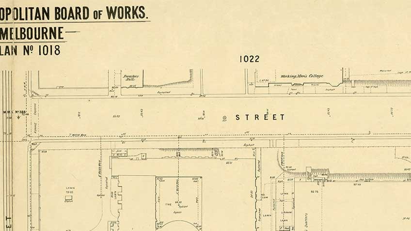
The Melbourne and Metropolitan Board of Works (MMBW) plans were produced from the 1890s to the 1950s. They were crucial to the design and development of Melbourne's sewerage and drainage system.
The plans, at a scale of 40 feet to 1 inch (1:480), provide a detailed historical record of Melbourne streetscapes and environmental features.
Following a major digitising project carried out in the past few years, these plans can be viewed online from our catalogue. This project has helped preserve the fragile originals and provides a digital version with added functionality and convenience for users.
Each plan covers one or two street blocks (roughly six streets), showing details of buildings, including garden layouts and ownership boundaries, and features such as laneways, drains, bridges, parks, municipal boundaries and other prominent landmarks as they existed at the time each plan was produced.
Maps at smaller scales (1:1920 and 1:4800) were produced at the same time, and also in the 1930s, and give an overview of suburban development.
We also hold MMBW maps from the 1970s and 1980s at a scale of 1:2500 in both paper format and on microfiche. These show contours, roads, block outlines and some public buildings and are useful for land-use, architecture and design projects.

![MMBW 400 feet to 1 inch plan [no 7] showing portion of Carlton and Fitzroy, 1897 MMBW 400 feet to 1 inch plan [no 7] showing portion of Carlton and Fitzroy, 1897](https://www.slv.vic.gov.au/sites/default/files/styles/feature_image/public/mmbw_detail.jpg?itok=lvoF1TSF)


![MMBW 400 feet to 1 inch plan [no 7] showing portion of Carlton and Fitzroy, 1897 MMBW 400 feet to 1 inch plan [no 7] showing portion of Carlton and Fitzroy, 1897](https://www.slv.vic.gov.au/sites/default/files/styles/carousel_thumbnails/public/mmbw_detail.jpg?itok=3XNVsdFL)